New projects on the geoportal of the Kaluga region
29 january, 2021
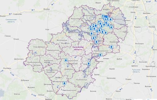
An interactive map of springs will be launched in the Kaluga Region. This decision was made at a meeting at the regional Ministry of Nature.
It is planned to show not only information on the location and improvement of springs on the interactive map, but also information on the quality of drinking water. The map, as well as collections dedicated to the springs, will appear in pilot municipalities by the end of 2021. While on the regional geoportal in the section Specially protected natural territories, the location of natural sources is available in this form:
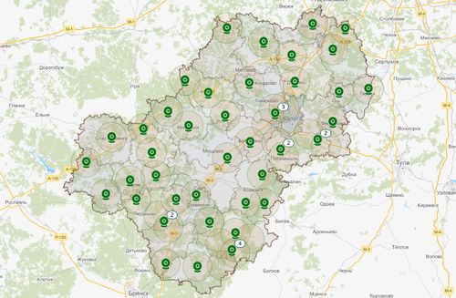
Also, on the interactive map of the Kaluga region sites of forest fires and smoke will be marked. The project is being developed by the Ministry together with the state-owned enterprise Kalugainformtech. The map will reflect the data of the system of remote monitoring and early detection of forest fires "Lesohranitel". It is displayed on the portal in the section of the same name: